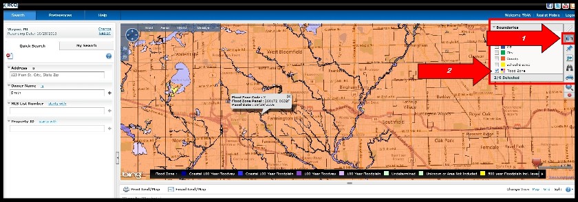
A: To view the Flood Zone information, choose the "Realist Tax" option from the RCO3 menu. Once you have a map displayed on your screen, move to your desired area of the map and zoom in. Click the "Boundaries" icon on the upper right side of the map and then "Flood Zones" (see image below). Once you've added that map layer, you can hold down your Ctrl-key and click on the map for a pop up window that shows the FEMA Zone Code, Panel Number, and Date. If you have any trouble, it may be that you need to zoom in further.
